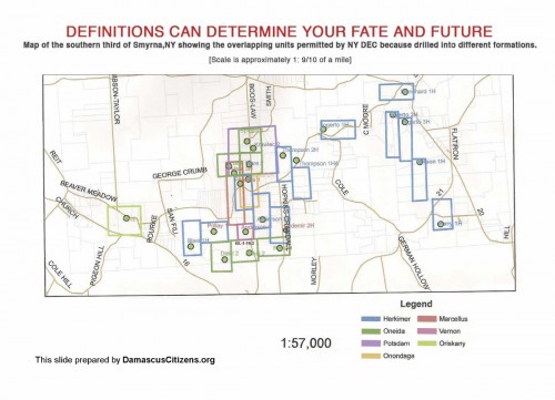
Here we are going back a decade, with the pro-drilling minority calling names and distorting the reality of property ownership, who actually pays the taxes, and for that matter, the moral, ethical, and in PA the …
- All
- Accidents
- Advocates
- Air Pollution
- Air Testing
- Art
- Associated Press
- Banned Here
- Biomass
- Blog
- Breaking News
- Climate Change
- Colorado
- Connecticut
- Cumulative
- DCS Programs
- DCS Storefront
- Decline Rate
- Delaware
- Dimock PA
- Divestment
- DRBC
- Earthquakes
- Economic
- Events
- Experts
- Federal / EPA
- FIMFO
- Gas Drilling Tech Notes
- Gas Industry
- Gasland
- Geology
- Global Market
- Health
- Health Impact Registry
- Impacts
- Industry Documents
- Industry Hype
- Jobs
- Landscape Disturbance
- Legal Action
- Legislation
- Maps / Aerial Views
- Maryland
- Methane Baselines
- Methane Emissions
- Mortgages
- New Jersey
- New York
- New York Times
- News Archives
- News Stories
- Ohio
- Pellet Stoves
- Pennsylvania
- Philadelphia Inquirer
- Pittsburgh Post-Gazette
- Political Influence
- Press Releases
- Print, Post, Share
- ProPublica Series
- Radioactivity
- Radon
- Real Estate
- Regulatory
- Regulatory Failure
- Renewables
- Reports / Studies
- Resources
- Reuters
- River Reporter
- Rural Economies
- Scranton Times-Tribune
- Secrecy / NDAs
- Skinners Falls Bridge
- SRBC
- Take Action
- The Wall Street Journal
- Toxic Chemicals
- Uncategorized
- Video
- Waste and Disposal
- Water Contamination
- Water Testing
- Wildlife
- Workers
- Zoning
- Zoning Assistance
Despite Governor Cuomo’s recent ban on hydraulic fracturing in New York State, there are many existing active oil and gas wells in the state. The following map shows New York State Oil and Gas Wells by Production Formation, as of …
By Jessica Robertson and Mark Petersen, USGS, July 17, 2014
To help make the best decisions to protect …
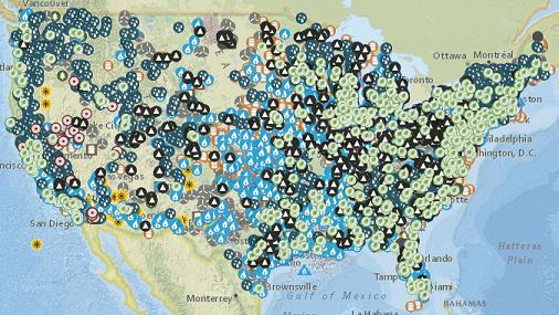
Interactive maps display facets of the United States energy infrastructure
The U.S. Energy Mapping System, brought to you by the U.S. Energy Information Administration, displays customizable maps of the U.S. energy infrastructure, including coal mines, power plants, refineries, …
Some of you have probably already seen the map I created which shows gas development in Susquehanna County PA:
The light purple is the Upper Susquehanna River Basin. The yellow squares are well pads. The green push-pins are compressor stations
The Allegheny National Forest region has been significantly fragmented by rampant oil and gas drilling. This slideshow documents these impacts. All of the photos are within the Allegheny, though some of the photos could be private in-holdings within the national …
Marcellus-Shale.Us
This Marcellus Shale gas drilling website is dedicated to providing photos, facts, opinions, stories and news about the Marcellus Shale gas play that you won’t find other places. You’ll find extensive photos of gas drilling sites, pipeline construction, well …
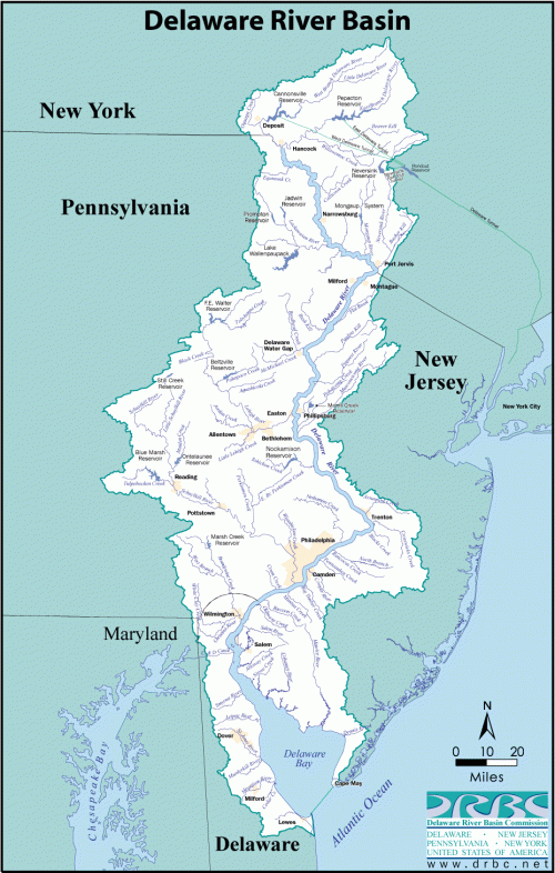
DCS has fought to prevent the massive drilling that has occurred all across the country from occurring in the Delaware River Basin. The gas industry maintains that gas extraction is a safe and effective method that does not disrupt local …
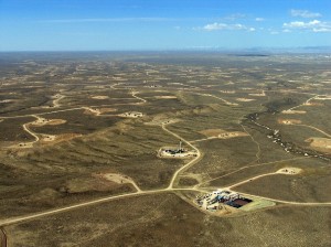
After working for 15 years as an exploration consultant to the oil-and-gas industry, using satellite imagery to hunt for likely drilling sites, John Amos had a road-to-Damascus moment when he viewed satellite imagery of wells in …

